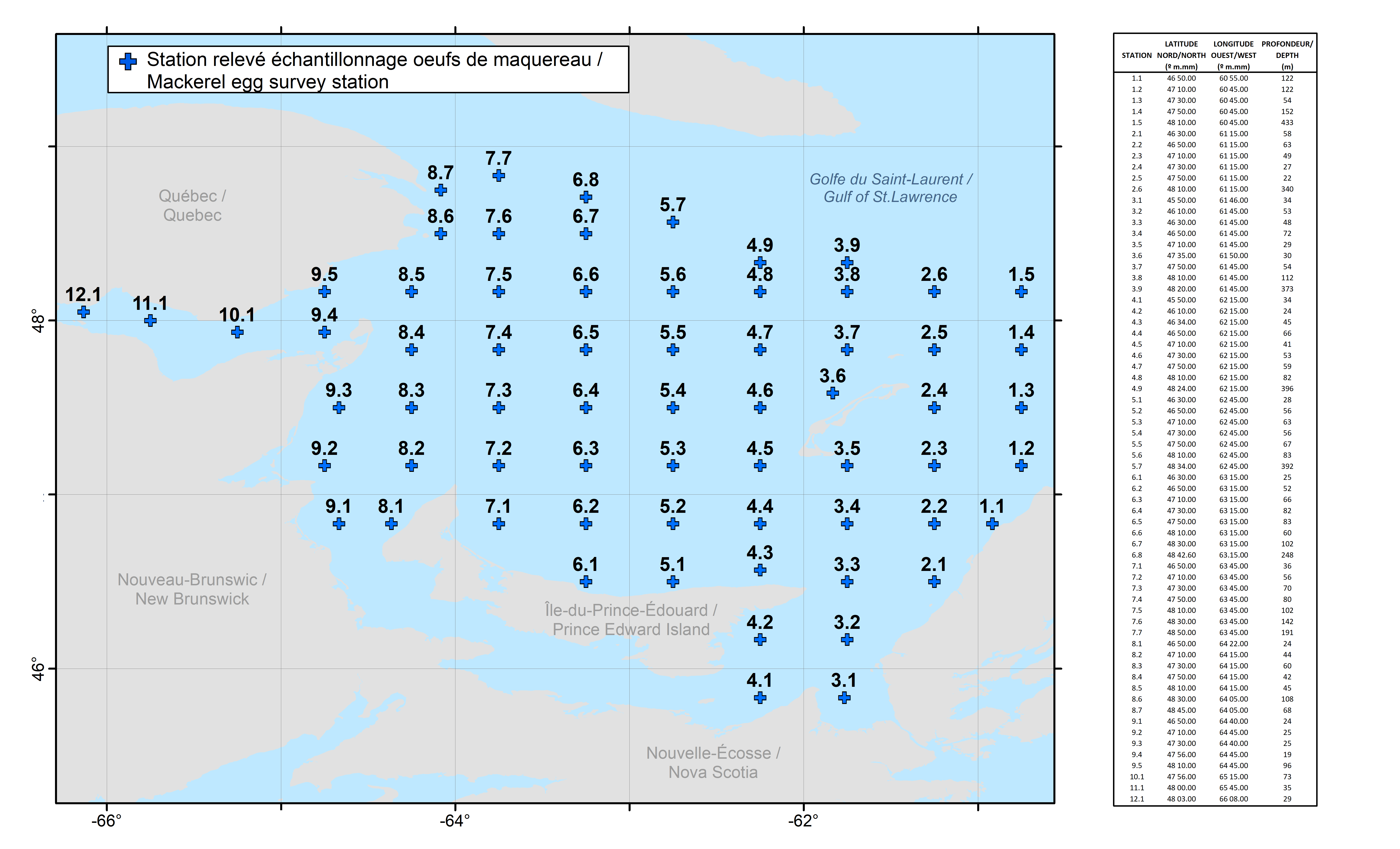
Map of primary mackerel egg survey stations (English, French, PNG)
View metadata and access the original English/French PNG file: Map of primary mackerel egg survey stations.
- Format
- PNG
- Access
- file-only
- Publisher-reported update
- 2026-03-24
Since 1979, Fisheries and Oceans Canada has conducted near-annual mackerel egg surveys in the southern Gulf of St. Lawrence using a standardized methodology. This survey typically takes place over approximately 10 days in June and aims to quantify mackerel eggs, thereby contributing to the stock assessment of the northern contingent. Sampling is conducted at 66 fixed stations arranged in a predefined grid (see included image for station locations and names). Additional stations—following the same sampling methodology—have also been surveyed off of southwestern Newfoundland, eastern Cape Breton and south of Prince Edward Island, as well as in other regions. The mackerel survey is often coordinated with the Atlantic Zone Monitoring Program (AZMP) for the Quebec region, which takes place around the same time using the same research vessel and similar equipment. While these two surveys are distinct, they are coordinated to complement each other. At each station, a tow using 61 cm bongo nets (333 µm mesh size) is towed following a saw-tooth profile through the upper 50 m of the water column. Tows last approximately 10 minutes at a speed of roughly 2.5 knots. These tows target mackerel…
Data overview
- Formats
- PNG
- File languages
- English, French
- Available actions
- Access original file